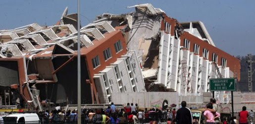
Earthquake
An earthquake (also known as a quake, tremor or temblor) is the result of a sudden release of energy in the Earth's crust that creates seismic waves.
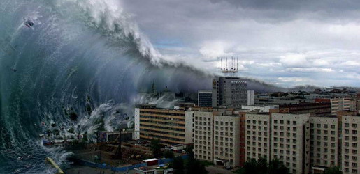
Tsunami
A tsunami also called a tsunami wave train, and at one time incorrectly referred to as a tidal wave, is a series of water waves caused by the displacement of a large volume of a body of water, usually an ocean, though it can occur in large lakes.
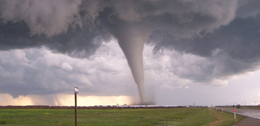
Tornado
A tornado (often referred to as a twister or, erroneously, a cyclone) is a violent, dangerous, rotating column of air that is in contact with both the surface of the earth and a cumulonimbus cloud or, in rare cases, the base of a cumulus cloud.
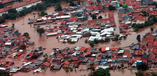
Floods
A flood is an overflow of an expanse of water that submerges land. The EU Floods directive defines a flood as a temporary covering by water of land not normally covered by water
Volcanic Eruptions
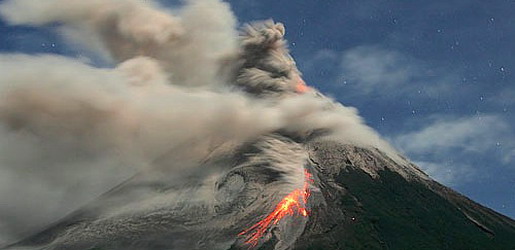
Volcanoes can cause widespread destruction and consequent disaster through several ways. The effects include the volcanic eruption itself that may cause harm following the explosion of the volcano or the fall of rock.
Tropical Cyclone Formation
10:03 AM
Posted by Disaster
Worldwide, tropical cyclone activity peaks in late summer, when the difference between temperatures aloft and sea surface temperatures is the greatest. However, each particular basin has its own seasonal patterns. On a worldwide scale, May is the least active month, while September is the most active while November is the only month with all the tropical cyclone basins active.
Times
In the Northern Atlantic Ocean, a distinct cyclone season occurs from June 1 to November 30, sharply peaking from late August through September. The statistical peak of the Atlantic hurricane season is 10 September. The Northeast Pacific Ocean has a broader period of activity, but in a similar time frame to the Atlantic. The Northwest Pacific sees tropical cyclones year-round, with a minimum in February and March and a peak in early September. In the North Indian basin, storms are most common from April to December, with peaks in May and November. In the Southern Hemisphere, the tropical cyclone year begins on July 1 and runs all year round and encompasses the tropical cyclone seasons which run from November 1 until the end of April with peaks in mid-February to early March.
| Season lengths and seasonal averages | |||||
|---|---|---|---|---|---|
| Basin | Season start | Season end | Tropical Storms (>34 knots) | Tropical Cyclones (>63 knots) | Category 3+ TCs (>95 knots) |
| Northwest Pacific | April | January | 26.7 | 16.9 | 8.5 |
| South Indian | November | April | 20.6 | 10.3 | 4.3 |
| Northeast Pacific | May | November | 16.3 | 9.0 | 4.1 |
| North Atlantic | June | November | 10.6 | 5.9 | 2.0 |
| Australia Southwest Pacific | November | April | 9 | 4.8 | 1.9 |
| North Indian | April | December | 5.4 | 2.2 | 0.4 |
Factors
The formation of tropical cyclones is the topic of extensive ongoing research and is still not fully understood. While six factors appear to be generally necessary, tropical cyclones may occasionally form without meeting all of the following conditions. In most situations, water temperatures of at least 26.5 °C (79.7 °F) are needed down to a depth of at least 50 m (160 ft); waters of this temperature cause the overlying atmosphere to be unstable enough to sustain convection and thunderstorms. Another factor is rapid cooling with height, which allows the release of the heat of condensation that powers a tropical cyclone. High humidity is needed, especially in the lower-to-mid troposphere; when there is a great deal of moisture in the atmosphere, conditions are more favorable for disturbances to develop. Low amounts of wind shear are needed, as high shear is disruptive to the storm's circulation. Tropical cyclones generally need to form more than 555 km (345 mi) or 5 degrees of latitude away from the equator, allowing the Coriolis effect to deflect winds blowing towards the low pressure center and creating a circulation. Lastly, a formative tropical cyclone needs a pre-existing system of disturbed weather, although without a circulation no cyclonic development will take place. Low-latitude and low-level westerly wind bursts associated with the Madden-Julian oscillation can create favorable conditions for tropical cyclogenesis by initiating tropical disturbances.
Locations
Most tropical cyclones form in a worldwide band of thunderstorm activity called by several names: the Intertropical Front (ITF), the Intertropical Convergence Zone (ITCZ), or the monsoon trough. Another important source of atmospheric instability is found in tropical waves, which cause about 85% of intense tropical cyclones in the Atlantic ocean, and become most of the tropical cyclones in the Eastern Pacific basin.
Tropical cyclones move westward when equatorward of the subtropical ridge, intensifying as they move. Most of these systems form between 10 and 30 degrees away of the equator, and 87% form no farther away than 20 degrees of latitude, north or south. Because the Coriolis effect initiates and maintains tropical cyclone rotation, tropical cyclones rarely form or move within about 5 degrees of the equator, where the Coriolis effect is weakest. However, it is possible for tropical cyclones to form within this boundary as Tropical Storm Vamei did in 2001 and Cyclone Agni in 2004.Tropical Cyclone Mechanics
10:00 AM
Posted by Disaster

A tropical cyclone's primary energy source is the release of the heat of condensation from water vapor condensing, with solar heating being the initial source for evaporation. Therefore, a tropical cyclone can be visualized as a giant vertical heat engine supported by mechanics driven by physical forces such as the rotation and gravity of the Earth. In another way, tropical cyclones could be viewed as a special type of mesoscale convective complex, which continues to develop over a vast source of relative warmth and moisture. While an initial warm core system, such as an organized thunderstorm complex, is necessary for the formation of a tropical cyclone, a large flux of energy is needed to lower atmospheric pressure more than a few millibars (0.10 inch of mercury). The inflow of warmth and moisture from the underlying ocean surface is critical for tropical cyclone strengthening. A significant amount of the inflow in the cyclone is in the lowest 1 kilometre (3,300 ft) of the atmosphere.
Condensation leads to higher wind speeds, as a tiny fraction of the released energy is converted into mechanical energy; the faster winds and lower pressure associated with them in turn cause increased surface evaporation and thus even more condensation. Much of the released energy drives updrafts that increase the height of the storm clouds, speeding up condensation. This positive feedback loop, called the Wind-induced surface heat exchange, continues for as long as conditions are favorable for tropical cyclone development. Factors such as a continued lack of equilibrium in air mass distribution would also give supporting energy to the cyclone. The rotation of the Earth causes the system to spin, an effect known as the Coriolis effect, giving it a cyclonic characteristic and affecting the trajectory of the storm.
What primarily distinguishes tropical cyclones from other meteorological phenomena is deep convection as a driving force. Because convection is strongest in a tropical climate, it defines the initial domain of the tropical cyclone. By contrast, mid-latitude cyclones draw their energy mostly from pre-existing horizontal temperature gradients in the atmosphere. To continue to drive its heat engine, a tropical cyclone must remain over warm water, which provides the needed atmospheric moisture to keep the positive feedback loop running. When a tropical cyclone passes over land, it is cut off from its heat source and its strength diminishes rapidly.
The passage of a tropical cyclone over the ocean causes the upper layers of the ocean to cool substantially, which can influence subsequent cyclone development. This cooling is primarily caused by wind-driven mixing of cold water from deeper in the ocean and the warm surface waters. This effect results in a negative feedback process which can inhibit further development or lead to weakening. Additional cooling may come in the form of cold water from falling raindrops (this is because the atmosphere is cooler at higher altitudes). Cloud cover may also play a role in cooling the ocean, by shielding the ocean surface from direct sunlight before and slightly after the storm passage. All these effects can combine to produce a dramatic drop in sea surface temperature over a large area in just a few days.
Scientists estimate that a tropical cyclone releases heat energy at the rate of 50 to 200 exajoules (1018 J) per day, equivalent to about 1 PW (1015 watt). This rate of energy release is equivalent to 70 times the world energy consumption of humans and 200 times the worldwide electrical generating capacity, or to exploding a 10-megaton nuclear bomb every 20 minutes.[19][26]
In the lower troposphere, the most obvious motion of clouds is toward the center. However tropical cyclones also develop an upper-level (high-altitude) outward flow of clouds. These originate from air that has released its moisture and is expelled at high altitude through the "chimney" of the storm engine. This outflow produces high, cirrus clouds that spiral away from the center. The clouds thin as they move outwards from the center of the system and are evaporated. They may be thin enough for the sun to be visible through them. These high cirrus clouds may be the first signs of an approaching tropical cyclone. As air parcels are lifted within the eye of the storm the vorticity is reduced, causing the outflow from a tropical cyclone to have anti-cyclonic motion.
Physical Structure of a Tropical Cyclone
9:57 AM
Posted by Disaster

All tropical cyclones are areas of low atmospheric pressure in the Earth's atmosphere. The pressures recorded at the centers of tropical cyclones are among the lowest that occur on Earth's surface at sea level. Tropical cyclones are characterized and driven by the release of large amounts of latent heat of condensation, which occurs when moist air is carried upwards and its water vapor condenses. This heat is distributed vertically around the center of the storm. Thus, at any given altitude (except close to the surface, where water temperature dictates air temperature) the environment inside the cyclone is warmer than its outer surroundings.
Tropical Cyclone Eye and center
A strong tropical cyclone will harbor an area of sinking air at the center of circulation. If this area is strong enough, it can develop into a large "eye". Weather in the eye is normally calm and free of clouds, although the sea may be extremely violent. The eye is normally circular in shape, and may range in size from 3 kilometres (1.9 mi) to 370 kilometres (230 mi) in diameter. Intense, mature tropical cyclones can sometimes exhibit an outward curving of the eyewall's top, making it resemble a football stadium; this phenomenon is thus sometimes referred to as the stadium effect.
There are other features that either surround the eye, or cover it. The central dense overcast is the concentrated area of strong thunderstorm activity near the center of a tropical cyclone; in weaker tropical cyclones, the CDO may cover the center completely. The eyewall is a circle of strong thunderstorms that surrounds the eye; here is where the greatest wind speeds are found, where clouds reach the highest, and precipitation is the heaviest. The heaviest wind damage occurs where a tropical cyclone's eyewall passes over land. Eyewall replacement cycles occur naturally in intense tropical cyclones. When cyclones reach peak intensity they usually have an eyewall and radius of maximum winds that contract to a very small size, around 10 kilometres (6.2 mi) to 25 kilometres (16 mi). Outer rainbands can organize into an outer ring of thunderstorms that slowly moves inward and robs the inner eyewall of its needed moisture and angular momentum. When the inner eyewall weakens, the tropical cyclone weakens (in other words, the maximum sustained winds weaken and the central pressure rises.) The outer eyewall replaces the inner one completely at the end of the cycle. The storm can be of the same intensity as it was previously or even stronger after the eyewall replacement cycle finishes. The storm may strengthen again as it builds a new outer ring for the next eyewall replacement.
| Size descriptions of tropical cyclones | |
|---|---|
| ROCI | Type |
| Less than 2 degrees latitude | Very small/midget |
| 2 to 3 degrees of latitude | Small |
| 3 to 6 degrees of latitude | Medium/Average |
| 6 to 8 degrees of latitude | Large anti-dwarf |
| Over 8 degrees of latitude | Very large |
Tropical Cyclone Size
One measure of the size of a tropical cyclone is determined by measuring the distance from its center of circulation to its outermost closed isobar, also known as its ROCI. If the radius is less than two degrees of latitude or 222 kilometres (138 mi), then the cyclone is "very small" or a "midget". A radius between 3 and 6 latitude degrees or 333 kilometres (207 mi) to 670 kilometres (420 mi) are considered "average-sized". "Very large" tropical cyclones have a radius of greater than 8 degrees or 888 kilometres (552 mi). Use of this measure has objectively determined that tropical cyclones in the northwest Pacific Ocean are the largest on earth on average, with Atlantic tropical cyclones roughly half their size. Other methods of determining a tropical cyclone's size include measuring the radius of gale force winds and measuring the radius at which its relative vorticity field decreases to 1×10⁻⁵ s−1 from its center.Tropical Cyclone
9:31 AM
Posted by Disaster
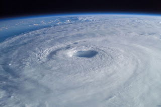
A tropical cyclone is a storm system characterized by a large low-pressure center and numerous thunderstorms that produce strong winds and heavy rain. Tropical cyclones strengthen when water evaporated from the ocean is released as the saturated air rises, resulting in condensation of water vapor contained in the moist air. They are fueled by a different heat mechanism than other cyclonic windstorms such as nor'easters, European windstorms, and polar lows. The characteristic that separates tropical cyclones from other cyclonic systems is that at any height in the atmosphere, the center of a tropical cyclone will be warmer than its surrounds; a phenomenon called "warm core" storm systems.
The term "tropical" refers to both the geographic origin of these systems, which form almost exclusively in tropical regions of the globe, and their formation in maritime tropical air masses. The term "cyclone" refers to such storms' cyclonic nature, with counterclockwise rotation in the Northern Hemisphere and clockwise rotation in the Southern Hemisphere. The opposite direction of spin is a result of the Coriolis force. Depending on its location and strength, a tropical cyclone is referred to by names such as hurricane, typhoon, tropical storm, cyclonic storm, tropical depression, and simply cyclone.
While tropical cyclones can produce extremely powerful winds and torrential rain, they are also able to produce high waves and damaging storm surge as well as spawning tornadoes. They develop over large bodies of warm water, and lose their strength if they move over land due to increased surface friction and loss of the warm ocean as an energy source. This is why coastal regions can receive significant damage from a tropical cyclone, while inland regions are relatively safe from receiving strong winds. Heavy rains, however, can produce significant flooding inland, and storm surges can produce extensive coastal flooding up to 40 kilometres (25 mi) from the coastline. Although their effects on human populations can be devastating, tropical cyclones can also relieve drought conditions. They also carry heat and energy away from the tropics and transport it toward temperate latitudes, which makes them an important part of the global atmospheric circulation mechanism. As a result, tropical cyclones help to maintain equilibrium in the Earth's troposphere, and to maintain a relatively stable and warm temperature worldwide.
Many tropical cyclones develop when the atmospheric conditions around a weak disturbance in the atmosphere are favorable. The background environment is modulated by climatological cycles and patterns such as the Madden-Julian oscillation, El Niño-Southern Oscillation, and the Atlantic multidecadal oscillation. Others form when other types of cyclones acquire tropical characteristics. Tropical systems are then moved by steering winds in the troposphere; if the conditions remain favorable, the tropical disturbance intensifies, and can even develop an eye. On the other end of the spectrum, if the conditions around the system deteriorate or the tropical cyclone makes landfall, the system weakens and eventually dissipates. It is not possible to artificially induce the dissipation of these systems with current technology.