Earthquake
An earthquake (also known as a quake, tremor or temblor) is the result of a sudden release of energy in the Earth's crust that creates seismic waves.

Tsunami
A tsunami also called a tsunami wave train, and at one time incorrectly referred to as a tidal wave, is a series of water waves caused by the displacement of a large volume of a body of water, usually an ocean, though it can occur in large lakes.

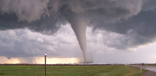
Tornado
A tornado (often referred to as a twister or, erroneously, a cyclone) is a violent, dangerous, rotating column of air that is in contact with both the surface of the earth and a cumulonimbus cloud or, in rare cases, the base of a cumulus cloud.

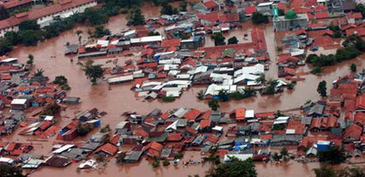
Floods
A flood is an overflow of an expanse of water that submerges land. The EU Floods directive defines a flood as a temporary covering by water of land not normally covered by water

Volcanic Eruptions
Volcanoes can cause widespread destruction and consequent disaster through several ways. The effects include the volcanic eruption itself that may cause harm following the explosion of the volcano or the fall of rock.

Phreatomagmatic Eruptions
6:17 AM
Posted by Disaster
Phreatomagmatic eruptions are eruptions that arise from interactions between water and magma. They are driven from thermal contraction (as opposed to magmatic eruptions, which are driven by thermal expansion) of magma when it comes in contact with water. This temperature difference between the two causes violent water-lava interactions that make up the eruption. The products of phreatomagmatic eruptions are believed to be more regular in shape and finer grained than the products of magmatic eruptions because of the differences in eruptive mechanisms.
There is debate about the exact nature of Phreatomagmatic eruptions, and some scientists believe that fuel-coolant reactions may be more critical to the explosive nature than thermal contraction. Fuel coolant reactions may fragment the volcanic material by propagating stress waves, widening cracks and increasing surface area that ultimetly lead to rapid cooling and explosive contraction-driven eruptions.
Surtseyan Eruptions
A Surtseyan eruption (or hydrovolcanic) is a type of volcanic eruption caused by shallow-water interactions between water and lava, named so after its most famous example, the eruption and formation of the island of Surtsey off the coast of Iceland in 1963. Surtseyan eruptions are the "wet" equivalent of ground-based Strombolian eruptions, but because of where they are taking place they are much more explosive. This is because as water is heated by lava, it flashes in steam and expands violently, fragmenting the magma it is in contact with into fine-grained ash. Surtseyan eruptions are the hallmark of shallow-water volcanic oceanic islands, however they are not specifically confined to them. Surtseyan eruptions can happen on land as well, and are caused by rising magma that comes into contact with an aquifer (water-bearing rock formation) at shallow levels under the volcano. The products of Surtseyan eruptions are generally oxidized palagonite basalts (though andesitic eruptions do occur, albeit rarely), and like Strombolian eruptions Surtseyan eruptions are generally continuous or otherwise rhythmic.A distinct defining feature of a Surtseyan eruption is the formation of a pyroclastic surge (or base surge), a ground hugging radial cloud that develops along with the eruption column. Base surges are caused by the gravitational collapse of a vaperous eruptive column, one that is denser overall then a regular volcanic column. The densest part of the cloud is nearest to the vent, resulting a wedge shape. Associated with these laterally moving rings are dune-shaped depositions of rock left behind by the lateral movement. These are occasionally disrupted by bomb sags, rock that was flung out by the explosive eruption and followed a ballistic path to the ground. Accumulations of wet, spherical ash known as accretionary lapilli is another common surge indicator.
Over time Surtseyan eruptions tend to form maars, broad low-relief volcanic craters dug into the ground, and tuff rings, circular structures built of rapidly quenched lava. These structures are associated with a single vent eruption, however if eruptions arise along fracture zones a rift zone may be dug out; these eruptions tend to be more violent then the ones forming a tuff ring or maars, an example being the 1886 eruption of Mount Tarawera. Littoral cones are another hydrovolcanic feature, generated by the explosive deposition of basaltic tephra (although they are not truly volcanic vents). They form when lava accumulates within cracks in lava, superheats and explodes in a steam explosion, breaking the rock apart and depositing it on the volcano's flank. Consecutive explosions of this type eventually generate the cone.
Volcanoes known to have Surtseyan activity include:
- Surtsey, Iceland. The volcano built itself up from depth and emerged above the Atlantic Ocean off the coast of Iceland in 1963. Initial hydrovolcanics were highly explosive, but as the volcano grew out rising lava started to interact less with the water and more with the air, until finally Surtseyan activity waned and became more Strombolian in character.
- Ukinrek Maars in Alaska, 1977, and Capelinhos in the Azores, 1957, both examples of above-water Surtseyan activity.
- Mount Tarawera in New Zealand erupted along a rift zone in 1886, killing 150 people.
- Ferdinandea, a seamount in the Mediterranean Sea, breached sea level in July 1831 and was the source of a dispute over sovereignty between Italy, France, and Great Britain. The volcano did not build tuff cones strongly enough to withstand erosion, and disappeared back below the waves soon after it appeared.
- The underwater volcano Hunga Tonga in Tonga breached sea level in 2009. Both of its vents exhibited Surtseyan activity for much of the time. It was also the site of an earlier eruption in May 1988.
Submarine Eruptions
Submarine eruptions are a type of volcanic eruption that occurs underwater. An estimated 75% of the total volcanic eruptive volume is generated by submarine eruptions near mid ocean ridges alone, however because of the problems associated with detecting deep sea volcanics, they remained virtually unknown until advances in the 1990s made it possible to observe them.Submarine eruptions are generated by seamounts (underwater volcanoes), and are driven by one of two processes. Volcanoes near plate boundaries and mid-ocean ridges are built by the decompression melting of mantle rock that floats up to the crustal surface. Eruptions near subducting zones, meanwhile, are driven by subducting plates that adds volatiles to the rising plate, raising its melting point. Each process generates different rock; mid-ocean ridge volcanics are primarily basaltic, whereas subduction flows are mostly calc-alkaline, and more explosive and viscous.
Spreading rates along mid-ocean ridges vary widely, from 2 cm (0.8 in) per year at the Mid-Atlantic Ridge, to up to 16 cm (6 in) along the East Pacific Rise. Higher spreading rates are a probably cause for higher levels of volcanism. The technology for studying seamount eruptions did not exist until advancements in hydrophone technology made it possible to "listen" to acoustic waves, known as T-waves, released by submarine earthquakes associated with submarine volcanic eruptions. The reason for this is that land-based seismometers cannot detect sea-based earthquakes below a magnitude of 4, but acoustic waves travel well in water and long periods of time. A system in the North Pacific, maintained by the United States Navy and originally intended for the detection of submarines, has detected an event on average every 2 to 3 years.
The most common underwater flow is pillow lava, a circular lava flow named after its unusual shape. Less common are glassy, marginal sheet flows, indicative of larger-scale flows. Volcaniclastic sedimentary rocks are common in shallow-water environments. As plate movement starts to carry the volcanoes away from their eruptive source, eruption rates start to die down, and water erosion grinds the volcano down. The final stages of eruption caps the seamount in alkalic flows. There are about 100,000 deepwater volcanoes in the world, although most are beyond the active stage of their life. Some exemplery seamounts are Loihi Seamount, Bowie Seamount, Cross Seamount, and Denson Seamount.
Subglacial Eruptions
Subglacial eruptions are a type of volcanic eruption characterized by interactions between lava and ice, often under a glacier. The nature of glaciovolcanism dictates that it occurs at areas of high latitude and high altitude. It has been suggested that subglacial volcanoes that are not actively erupting often dump heat into the ice covering them, producing meltwater. This meltwater mix means that subglacial eruptions often generate dangerous jökulhlaups (floods) and lahars.[40] The study of glaciovolcanism is still a relatively new field. Early accounts described the unusual flat-topped steep-sided volcanoes (called tuyas) in Iceland that were suggested to have formed from eruptions below ice. The first English-language paper on the subject was published in 1947 by William Henry Mathews, describing the Tuya Butte field in northwest British Columbia. The eruptive process that builds these structures, originally inferred in the paper, begins with volcanic growth below the glacier. At first the eruptions resemble those that occur in the deep sea, forming piles of pillow lava at the base of the volcanic structure. Some of the lava shatters when it comes in contact with the cold ice, forming a glassy breccia called hyaloclastite. After a while the ice finally melts into a lake, and the more explosive eruptions of Surtseyan activity begins, building up flanks made up of mostly hyaloclastite. Eventually the lake boils off from continued volcanism, and the lava flows become more effusive and thicken as the lava cools much more slowly, often forming columnar jointing. Well-preserved tuyas show all of these stages, for example Hjorleifshofdi in Iceland.
Products of volcano-ice interactions stand as various structures, whose shape is dependent on complex eruptive and environmental interactions. Glacial volcanism is a good indicator of past ice distribution, making it an important climatic marker. Since they are imbedded in ice, as ice retracts worldwide there are concerns that tuyas and other structures may destabalize, resulting in mass landslides. Evidence of volcanic-glacial interactions are evident in Iceland and parts of British Columbia, and it's even possible that they play a role in deglaciation.
Glaciovolcanic products have been identified in Iceland, British Columbia, Hawaii and Alaska, the Cascade Range, South America and even on the planet Mars. Volcanoes known to have subglacial activity include:
- Mauna Kea in tropical Hawaii. There is evidence of past subglacial eruptive activity on the volcano in the form of a subglacial deposit on its summit. The eruptions originated about 10,000 years ago, during the last ice age, when the summit of Mauna Kea was covered in ice.
- In 2008, the British Antarctic Survey reported a volcanic eruption under the Antarctica ice sheet 2,200 years ago. It is believed to be that this was the biggest eruption in Antarctica in the last 10,000 years. Volcanic ash deposits from the volcano were identified through an airborne radar survey, buried under later snowfalls in the Hudson Mountains, close to Pine Island Glacier.
- Iceland, well known for both glaciers and volcanoes, is often a site of subglacial eruptions. An example an eruption under the Vatnajökull ice cap in 1996, which occurred under an estimated 2,500 ft (762 m) of ice.
- As part of the search for life on Mars, scientists have suggested that there may be subglacial volcanoes on the red planet. Several potential sites of such volcanism have been reviewed, and compared extensively with similar features in Iceland: