Earthquake
An earthquake (also known as a quake, tremor or temblor) is the result of a sudden release of energy in the Earth's crust that creates seismic waves.

Tsunami
A tsunami also called a tsunami wave train, and at one time incorrectly referred to as a tidal wave, is a series of water waves caused by the displacement of a large volume of a body of water, usually an ocean, though it can occur in large lakes.

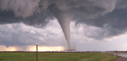
Tornado
A tornado (often referred to as a twister or, erroneously, a cyclone) is a violent, dangerous, rotating column of air that is in contact with both the surface of the earth and a cumulonimbus cloud or, in rare cases, the base of a cumulus cloud.

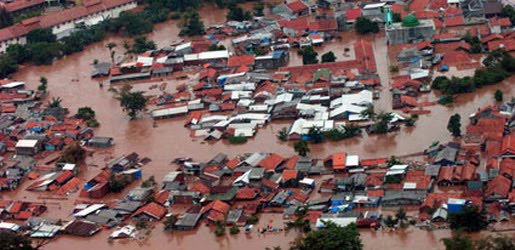
Floods
A flood is an overflow of an expanse of water that submerges land. The EU Floods directive defines a flood as a temporary covering by water of land not normally covered by water

Volcanic Eruptions
Volcanoes can cause widespread destruction and consequent disaster through several ways. The effects include the volcanic eruption itself that may cause harm following the explosion of the volcano or the fall of rock.

Hail Storms Short-Term Detection
12:42 AM
Posted by Disaster
Weather radar is a very useful tool to detect the presence of hail producing thunderstorms. However, radar data has to be complemented by a knowledge of current atmospheric conditions which can allow one to determine if the current atmosphere is conducive to hail development.
Modern radar scans many angles around the site. Reflectivity values at multiple angles above ground level in a storm are proportional to the precipitation rate at those levels. Summing reflectivities in the Vertically Integrated Liquid or VIL, gives the liquid water content in the cloud. Research shows that hail development in the upper levels of the storm is related to the evolution of VIL. VIL divided by the vertical extent of the storm, called VIL density, has a relationship with hail size, although this varies with atmospheric conditions and therefore is not highly accurate. Traditionally, hail size and probability can be estimated from radar data by computer using algorithms based on this research. Some algorithms include the height of the freezing level to estimate the melting of the hailstone and what would be left on the ground.
Certain patterns of reflectivity are important clues for the meteorologist as well. The three body scatter spike is an example. This is the result of energy from the radar hitting hail and being deflected to the ground, where they deflect back to the hail and then to the radar. The energy took more time to go from the hail to the ground and back, as opposed to the energy that went direct from the hail to the radar, and the echo is further away from the radar than the actual location of the hail on the same radial path, forming a cone of weaker reflectivities.
More recently, the polarization properties of weather radar returns have been analyzed to differentiate between hail and heavy rain. The use of differential reflectivity (Zdr), in combination with horizontal reflectivity (Zh) has led to a variety of hail classification algorithms. Visible satellite imagery is beginning to be used to detect hail, but false alarm rates remain high using this method.