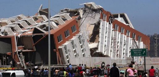
Earthquake
An earthquake (also known as a quake, tremor or temblor) is the result of a sudden release of energy in the Earth's crust that creates seismic waves.
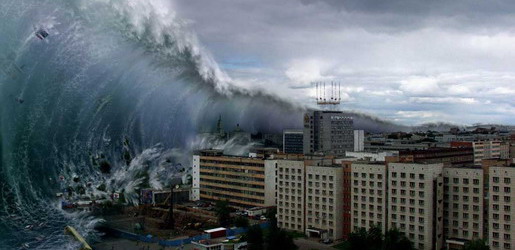
Tsunami
A tsunami also called a tsunami wave train, and at one time incorrectly referred to as a tidal wave, is a series of water waves caused by the displacement of a large volume of a body of water, usually an ocean, though it can occur in large lakes.
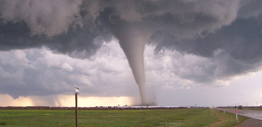
Tornado
A tornado (often referred to as a twister or, erroneously, a cyclone) is a violent, dangerous, rotating column of air that is in contact with both the surface of the earth and a cumulonimbus cloud or, in rare cases, the base of a cumulus cloud.
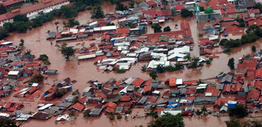
Floods
A flood is an overflow of an expanse of water that submerges land. The EU Floods directive defines a flood as a temporary covering by water of land not normally covered by water
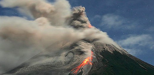
Volcanic Eruptions
Volcanoes can cause widespread destruction and consequent disaster through several ways. The effects include the volcanic eruption itself that may cause harm following the explosion of the volcano or the fall of rock.
Ice Storm Formation
12:16 PM

Ice storms occur when a layer of warm air is between two layers of cold air. Frozen precipitation melts while falling into the warm air layer, and then proceeds to refreeze in the cold layer above the ground. If the precipitate is partially melted, it will land on the ground as sleet. However, if the warm layer completely melts the precipitate, becoming rain, the liquid droplets will continue to fall, and pass through a thin layer of cold air just above the surface. This thin layer of air then cools the rain to a temperature below freezing (0 °C). However, the drops themselves do not freeze, a phenomenon called supercooling (or forming "supercooled drops"). When the supercooled drops strike ground below 0 °C or anything else below 0 °C (power lines, tree branches, aircraft), they instantly freeze, forming a thin film of ice, hence freezing rain.
While meteorologists can predict when and where an ice storm will occur, some storms still occur with little or no warning. Most ice storms are thought to form primarily in the north-eastern US, but damaging storms have occurred farther south. An ice storm in February 1994 resulted in tremendous ice accumulation as far south as Mississippi, and caused reported damage in nine states. More timber was damaged than that caused by Hurricane Camille. An ice storm in eastern Washington in November 1996 directly followed heavy snowfall. The combined weight of the snow and 25 millimetres (0.98 in) to 37 millimetres (1.5 in) of ice caused considerable widespread damage. This was considered to be the most severe ice storm in the Spokane area since 1940.