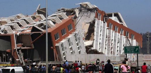
Earthquake
An earthquake (also known as a quake, tremor or temblor) is the result of a sudden release of energy in the Earth's crust that creates seismic waves.
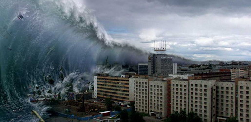
Tsunami
A tsunami also called a tsunami wave train, and at one time incorrectly referred to as a tidal wave, is a series of water waves caused by the displacement of a large volume of a body of water, usually an ocean, though it can occur in large lakes.
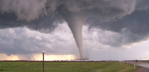
Tornado
A tornado (often referred to as a twister or, erroneously, a cyclone) is a violent, dangerous, rotating column of air that is in contact with both the surface of the earth and a cumulonimbus cloud or, in rare cases, the base of a cumulus cloud.
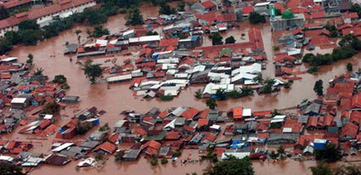
Floods
A flood is an overflow of an expanse of water that submerges land. The EU Floods directive defines a flood as a temporary covering by water of land not normally covered by water
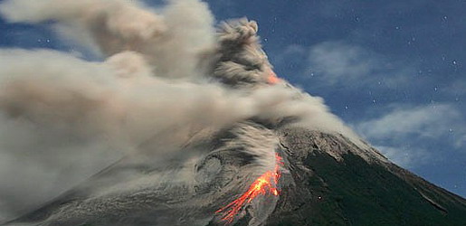
Volcanic Eruptions
Volcanoes can cause widespread destruction and consequent disaster through several ways. The effects include the volcanic eruption itself that may cause harm following the explosion of the volcano or the fall of rock.
Sendai Earthquake 2011
7:12 AM
The main earthquake was preceded by a number of large foreshocks, beginning with a 7.2 MW event on 9 March approximately 40 kilometers (25 mi) from 11 March quake, and followed by another three on the same day in excess of 6 MW in intensity. One minute prior to the earthquake, Earthquake Early Warning connected to about 1,000 seismometers in Japan sent out warnings on television of an impending earthquake to millions. This is believed to have saved innumerable lives.
The earthquake occurred in the western Pacific Ocean, 130 kilometers (81 mi) east of Sendai, Honshu, Japan. Its epicenter was 373 kilometers (232 mi) from Tokyo, according to the United States Geological Survey (USGS). Multiple aftershocks were reported after the initial magnitude 8.9 quake at 14:46 local time. A magnitude 7.0 aftershock was reported at 15:06 local time, M7.4 at 15:15 local time and M7.2 at 15:26 local time. Over one hundred aftershocks of magnitude 4.5 or greater have occurred since the initial quake.
Initially reported as 7.9 by the USGS, the magnitude was quickly restated as 8.8 and then to 8.9, and then again to either 9.0 or 9.1 according to some sources. This earthquake occurred in the Japan Trench, where the Pacific Plate is subducting beneath the Okhotsk Plate. A quake of this size usually has a rupture length of at least 480 kilometers (300 mi) and requires a long, relatively straight fault line. Because the plate boundary and subduction zone in this region is not very straight, earthquake magnitudes are usually expected to be between 8 and 8.5; the magnitude of this earthquake was a surprise to some seismologists. The hypocentral region of this earthquake extends from offshore Iwate to offshore Ibaraki Prefectures. The Japanese Meteorological Agency said that the earthquake may have ruptured the fault zone from Iwate to Ibaraki with a length of 400 kilometers (250 mi) and a width of 200 kilometers (120 mi). It has been pointed out that this earthquake may have had the same mechanism as that of another large earthquake in 869, which also caused a large tsunami.
The quake registered a maximum 7 on the Japan Meteorological Agency seismic intensity scale in Kurihara, Miyagi Prefecture. Three other prefectures—Fukushima, Ibaraki and Tochigi—recorded upper 6 on the JMA scale. Seismic stations in Iwate, Gunma, Saitama and Chiba Prefecture measured lower 6, recording upper 5 in Tokyo.
A local official at the hardest-hit city of Kurihara in Miyagi Prefecture, in a telephone interview by Agence France-Presse (AFP) said:
We were shaken so strongly for a while that we needed to hold on to something in order not to fall. We couldn't escape the building immediately because the tremors continued... City officials are now outside, collecting information on damage.
A separate earthquake measured magnitude of 6.7 by JMA occurred at 18:59 UTC, 11 March (03:59, 12 March local time). Its hypocenter was in Niigata Prefecture at a depth of 10 kilometers (6.2 mi). The quake was recorded upper 6 on the JMA intensity scale in Nagano Prefecture and lower 6 in Niigata. It also resulted in numerous aftershocks.